Digital Management Framework
In an era of rapid urbanization, effective city management requires digital tools that provide real-time insights and allow for strategic disaster planning.
The Digital Management Framework (DMF) is a revolutionary platform designed to transform urban management and decision-making through real-time data, AI-driven automation, 3D simulations, and digital twin design and development.
The Future of
Smart City
Management
As a leader in smart city innovation, DMF is redefining urban landscapes—bridging technology with strategic governance to build more resilient, adaptive, and intelligent cities for the future.
By reimagining how to design and develop a digital product management framework, our DMF design empowers city planners, decision-makers, and stakeholders to optimize resource allocation, enhance efficiency, and improve overall quality of life.

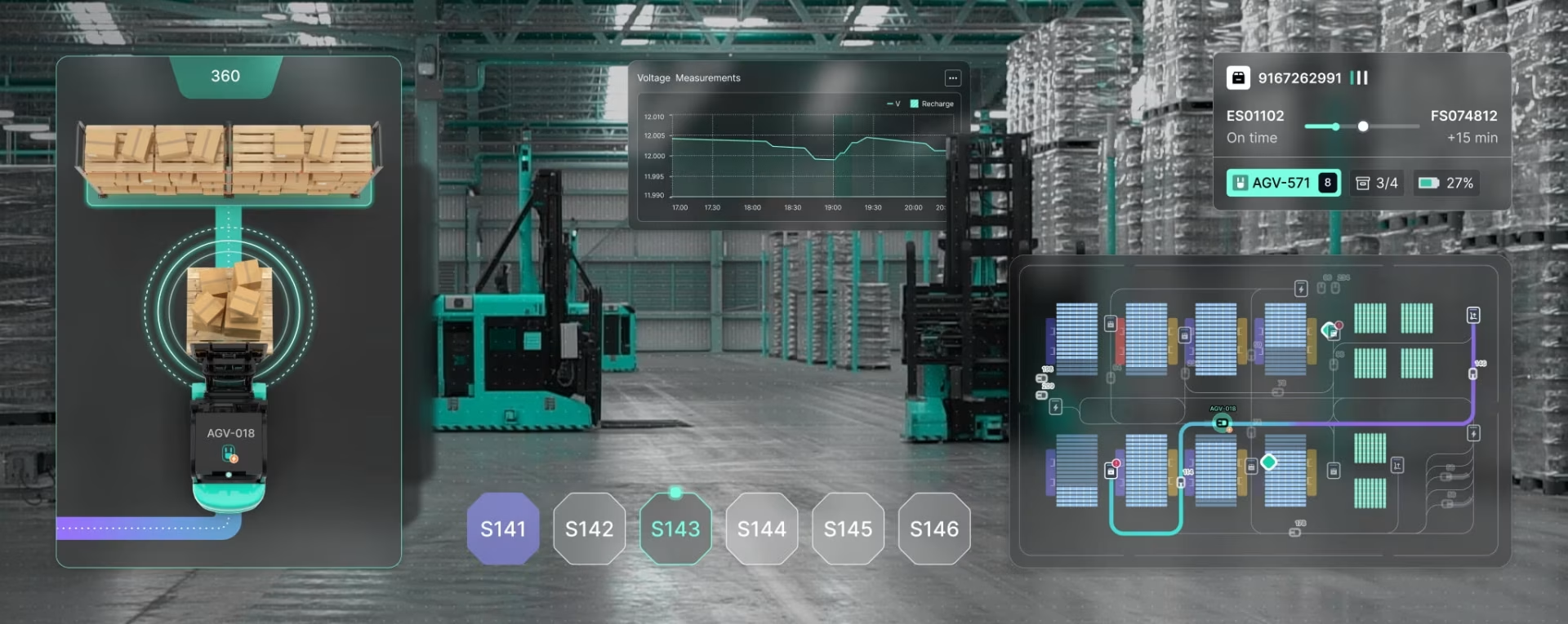
Surveillance &
Monitoring
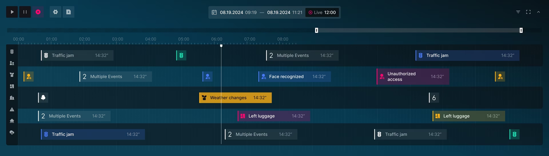
The Surveillance feature of the DMF example below provides advanced real-time monitoring and historical video analysis to enhance security and situational awareness. Through our expert use of platforms such as Exwalt, users can view, control, and manage live camera feeds, access recorded footage, and utilize AI-powered face recognition for real-time identity verification and alert functionality.


Enables precise navigation through historical video footage, enhancing security with advanced event tracking and digital twin-based analysis.
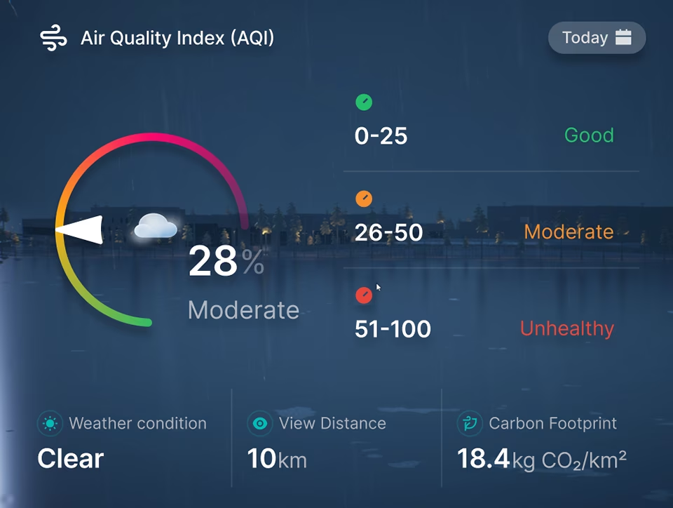
Smart Air Traffic
Insights
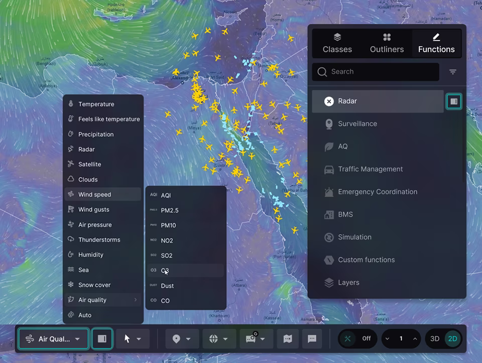
The Air Quality feature in the DMF digital asset management framework provides real-time and historical data visualization to help users assess environmental conditions and track pollution levels over time. With interactive 2D maps, detailed graphs, and immersive 3D city models, users can analyze air quality across different regions with clarity and precision.

Understanding the relationship between weather conditions and air quality is crucial for accurate forecasting and environmental planning. By combining historical trends with weather forecasts, cities can anticipate changes in air quality and take proactive measures.
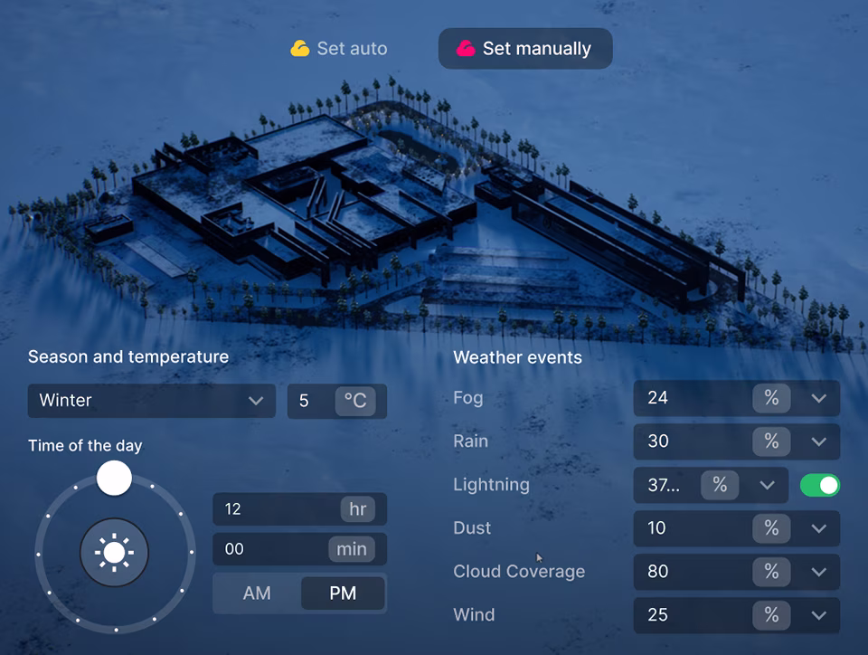
The Weather Radar provides critical data on wind patterns and weather conditions affecting air and maritime traffic. By integrating wind speed, direction, and forecasts, the system helps users notify and plan for weather-impacted flight and sea navigation patterns.
Terrain Sculpting
Tools
The Sculpting feature in Building/Editing mode allows users to precisely shape a digital twin interface with intuitive controls and unique services. Three core tools—Surface, Smooth, and Flat—enable effortless terrain modification, from creating elevated surfaces to leveling ground for urban development.

AI-Enhanced
Support
The AI Support feature of the DMF platform transforms urban management with advanced data analysis, predictive modeling based on decades of data, and decision-making assistance in real-time and for advanced planning needs. By processing large-scale city data—spanning traffic, energy, security, and environmental factors—AI identifies patterns, forecasts trends, and delivers real-time insights for proactive city planning.

Sea and Air
Navigation Radar
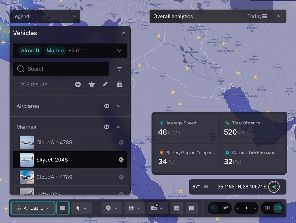
The Radar feature of the DMF platform provides real-time tracking of air and maritime traffic, ensuring enhanced situational awareness and safety. The re-routing of air traffic could not be more important for public safety and overall city efficiency and management. With live data, users can monitor aircraft and ships on an interactive 2D or 3D map, complete with detailed flight and vessel information, filtering options, and search capabilities.

Understanding the relationship between weather conditions and air quality is crucial for accurate forecasting and environmental planning. By combining historical trends with weather forecasts, cities can anticipate changes in air quality and take proactive measures. This is not just a safety mechanism, it is also a healthcare planning feature, as the numbers of asthma and other breathing ailments grows across the world.
The Weather Radar provides critical data on wind patterns and weather conditions affecting air and maritime traffic. By integrating wind speed, direction, and forecasts, the system helps users understand how weather may influence flight or sea navigation and provide vessels travel options and guidance in real-time based on their exact location and the immediate conditions surrounding the vessel.
Designed by:
Art Direction
George Railean
Project management
Vladimir Bobu
Design
Lina Ghimp, Vitalie Ghimciuc
Do you want to create something similar?
Get a free estimation for your project requirements and start it within 24 hours.
Related Services and Solutions
Don't Listen to Us, Read What Our Clients Are Saying.
We know that trusting an outsider with your vision can be scary. This is why if you're not satisfied with us after the first two weeks, you can walk away owing us nothing.
"We went from prototype to usable software lightening fast, and our customer reviews have never been better."
"Their creativity and mastery of UX UI design has made our years of working together enjoyable and incredibly successful!"
"If you need to re-think your product and need some truly unique design talent , Fuselab Creative design team is your answer."
"We needed a nimble team of UI UX designers to work with our development team and they quickly became one of our most vital resources and far exceeded our expectations."