Drone Forge
A personal AI platform for memory, identity, relationships, and reflection.
A premium control environment for managing live UAV missions
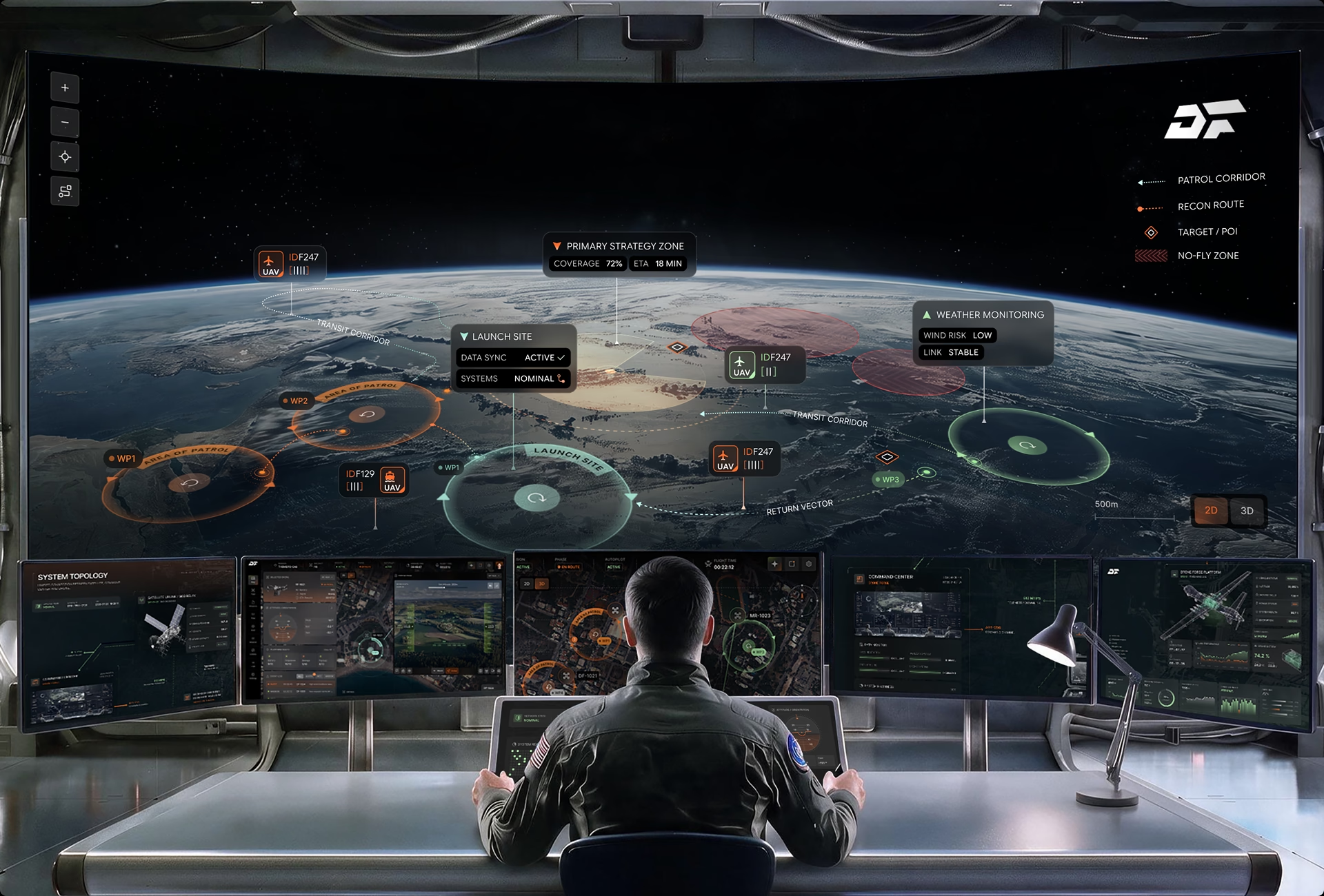
Drone Forge operates un-maned aircraft across defense, mining, and emergency response programs in Australia, and is the Asia-Pacific launch customer for the Airbus Flexrotor VTOL. The UAV mission control environment shown here we designed for that kind of multi-platform operation, bringing live fleet status, airframe telemetry, weather readiness, and satellite-linked command into a single interface.
One Engagement, Five Connected Systems
Fuselab Creative designed the entire platform shown in this case study: app development, dashboard design, data visualization, and interface design and UX across fleet operations, airframe telemetry, launch readiness, satellite link topology, and manual control. Every screen belongs to a single product, and every render is the work itself.
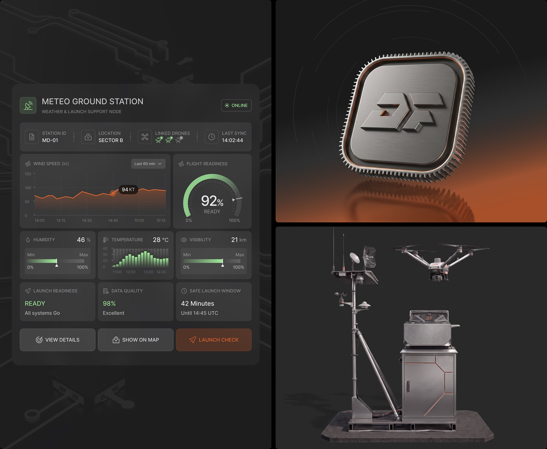
Weather & Launch Support
Drone Forge operations extend beyond the aircraft into field infrastructure.
The Meteo Ground Station turns local atmospheric readings into operational readiness data, helping teams validate safe launch windows and reduce weather-related mission risk.
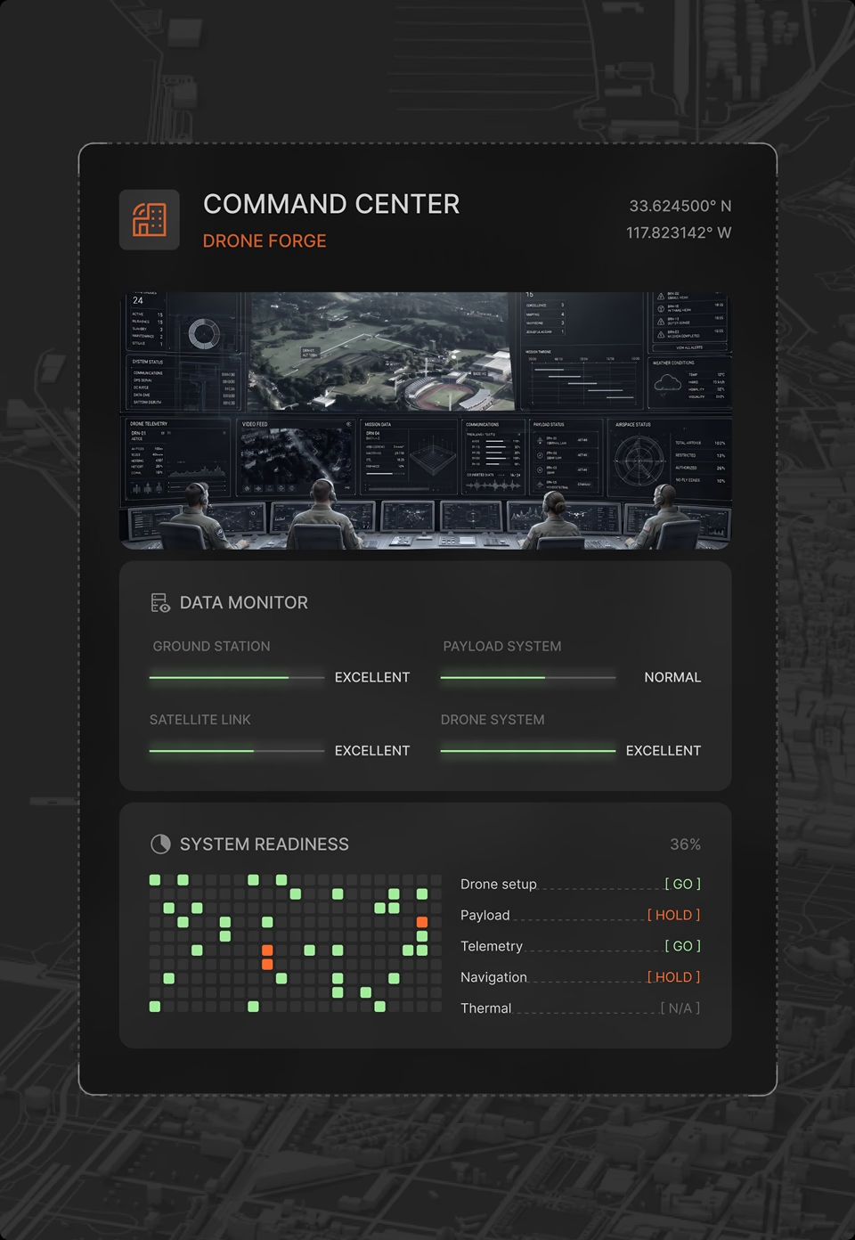
A launch decision compresses wind, humidity, visibility, and a closing time window into one call. The interface answers it in that order: a single flight readiness figure anchors the screen, the safe launch window sits beside it with a countdown, and the raw meteorology stays one level below for the operator who wants to interrogate the number.
Launch Readiness
The Meteo Ground Station converts wind, visibility, and humidity readings into a clear go or hold call.
Airframe Diagnostics
Live health monitoring across airframe, battery, propulsion, payload, and secure data links.
Fleet Operations Map
A map-centered view of every active mission, with drone feeds, event logs, and sector status.
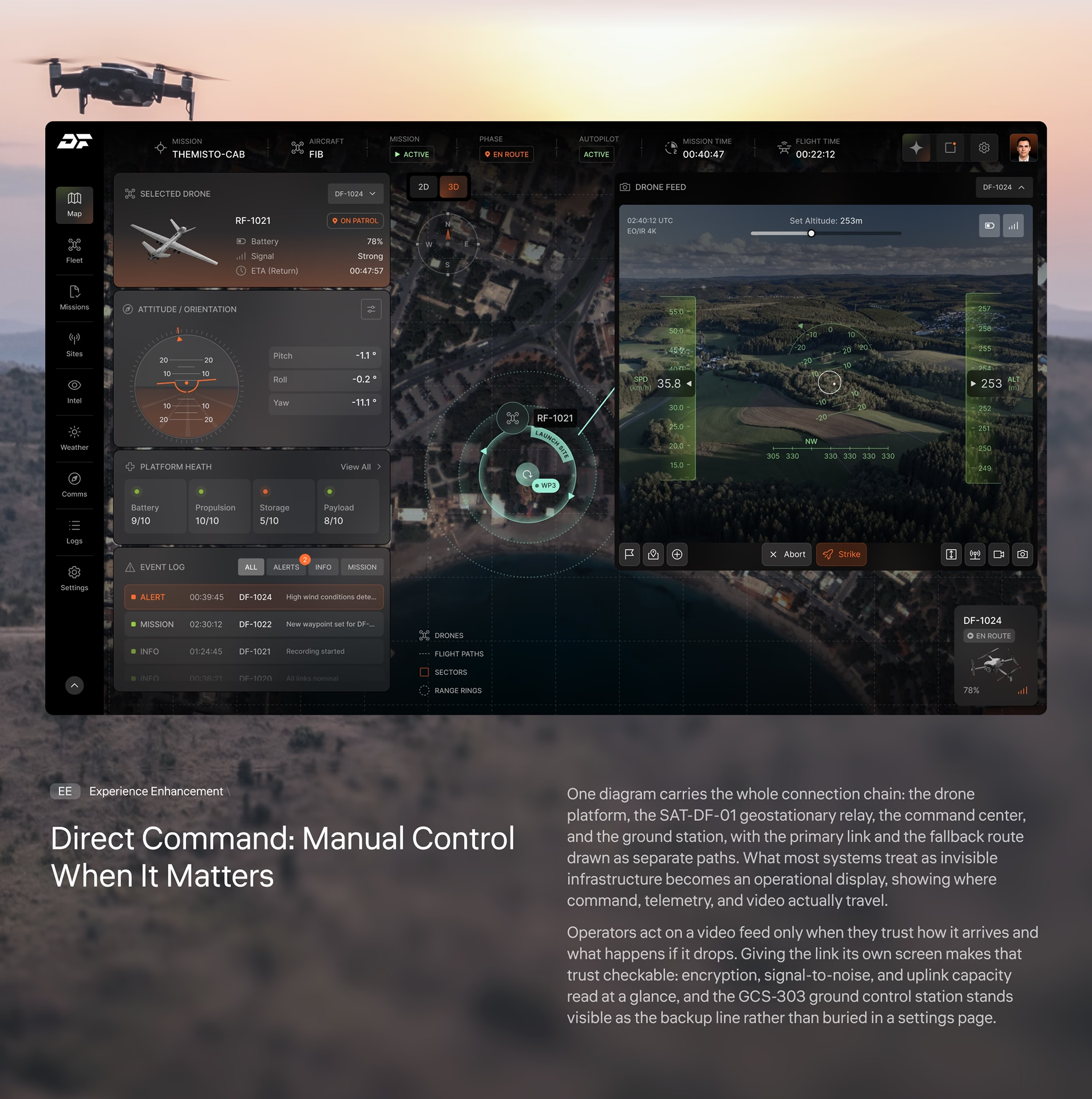
Direct Command
Operators open a live feed, issue commands, or take manual control of any unit in seconds.
Satellite Link Topology
The full command chain from geo relay to ground station and aircraft, mapped as one architecture.
Airframe System Status: Diagnostics And Health Monitoring
Between launch and recovery, this is the aircraft’s medical chart. A live schematic of the fixed-wing platform sits at the center, surrounded by the numbers that decide the next hour: system readiness, endurance, propulsion efficiency, and payload state. Together they answer whether the aircraft continues, adjusts, or comes home.
Mid-mission, an operator does not read a dashboard. They scan it for what changed. Nominal systems stay visually quiet, warnings carry the only warm color on the panel, and every subsystem, from the battery module to the AES-256 link, reports its state the same way, so one scan covers the whole aircraft. UAV telemetry earns attention only when it demands a decision.
Fleet Operations Map: Multi-Drone Mission Management
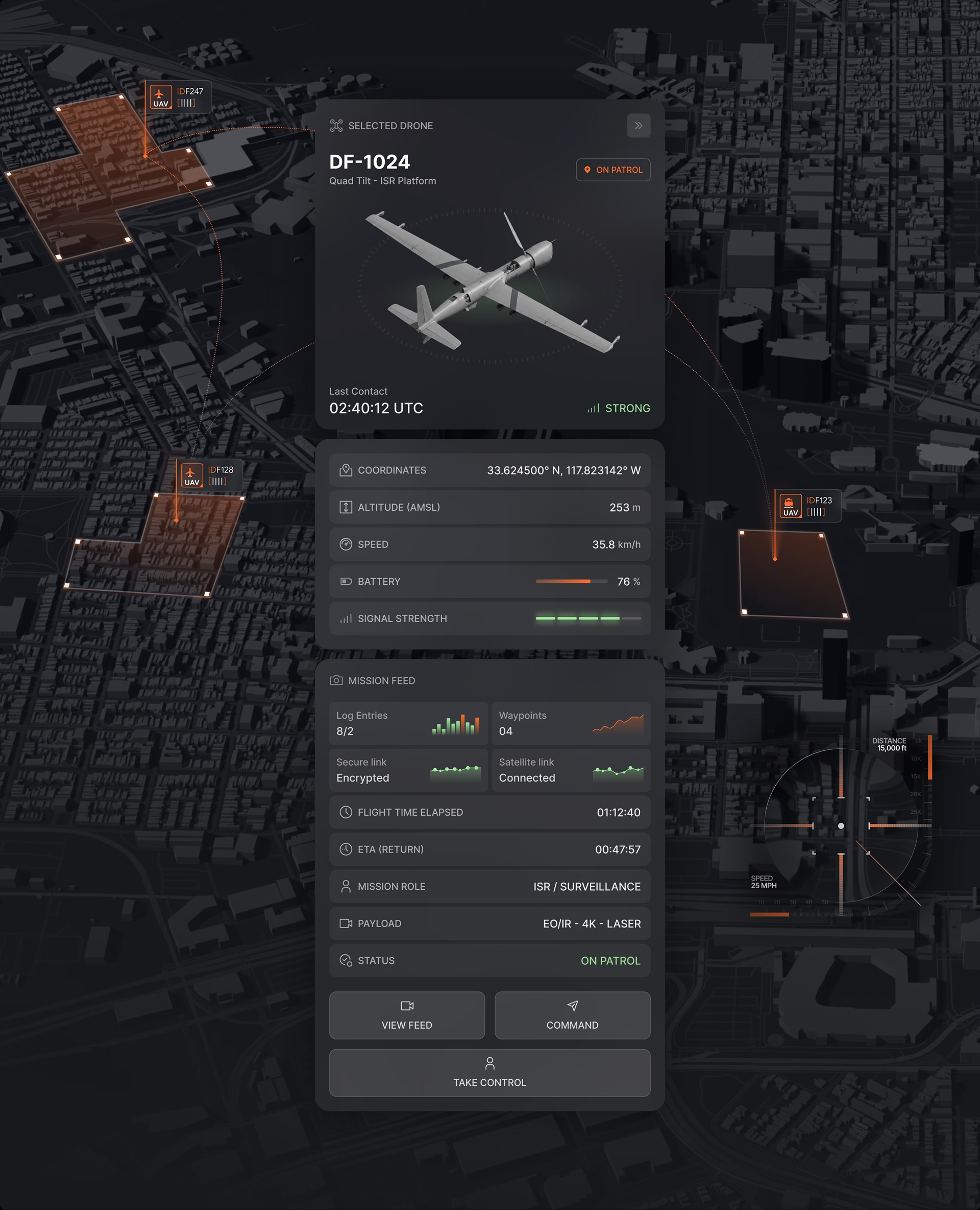
The operations map is where a mission actually runs. Every active unit appears over live terrain with its patrol area, waypoints, and status, while the side panel tracks the full fleet across airborne, standby, returning, and offline states. Sector occupancy, mission phase, and the event log sit on the same screen, so the operator never leaves the map to know what is happening.
Commanding twelve aircraft fails when every drone asks for equal attention. The map ranks the fleet by exception: sectors and alerts surface first, and the selected-drone panel, shown here on DF-1024, carries full telemetry only for the unit that needs a decision. Drone fleet management at this scale is an attention budget, and the layout spends it deliberately.
System Topology: Satellite, Command & Drone Links
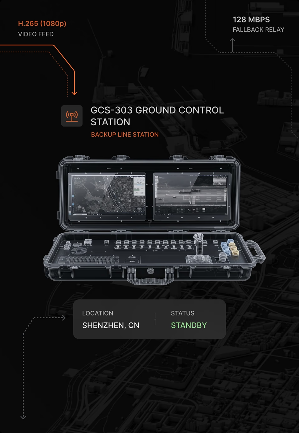
One diagram carries the whole connection chain: the drone platform, the SAT-DF-01 geostationary relay, the command center, and the ground station, with the primary link and the fallback route drawn as separate paths. What most systems treat as invisible infrastructure becomes an operational display, showing where command, telemetry, and video actually travel.
Operators act on a video feed only when they trust how it arrives and what happens if it drops. Giving the link its own screen makes that trust checkable: encryption, signal-to-noise, and uplink capacity read at a glance, and the GCS-303 ground control station stands visible as the backup line rather than buried in a settings page.
Unified Mission Ecosystem
Most drone programs run on separate tools from separate vendors: one for weather, one for telemetry, one for the fleet map, one for the link. Drone Forge was designed as one operational ecosystem instead, so the handoffs between systems disappear from the operator’s day.
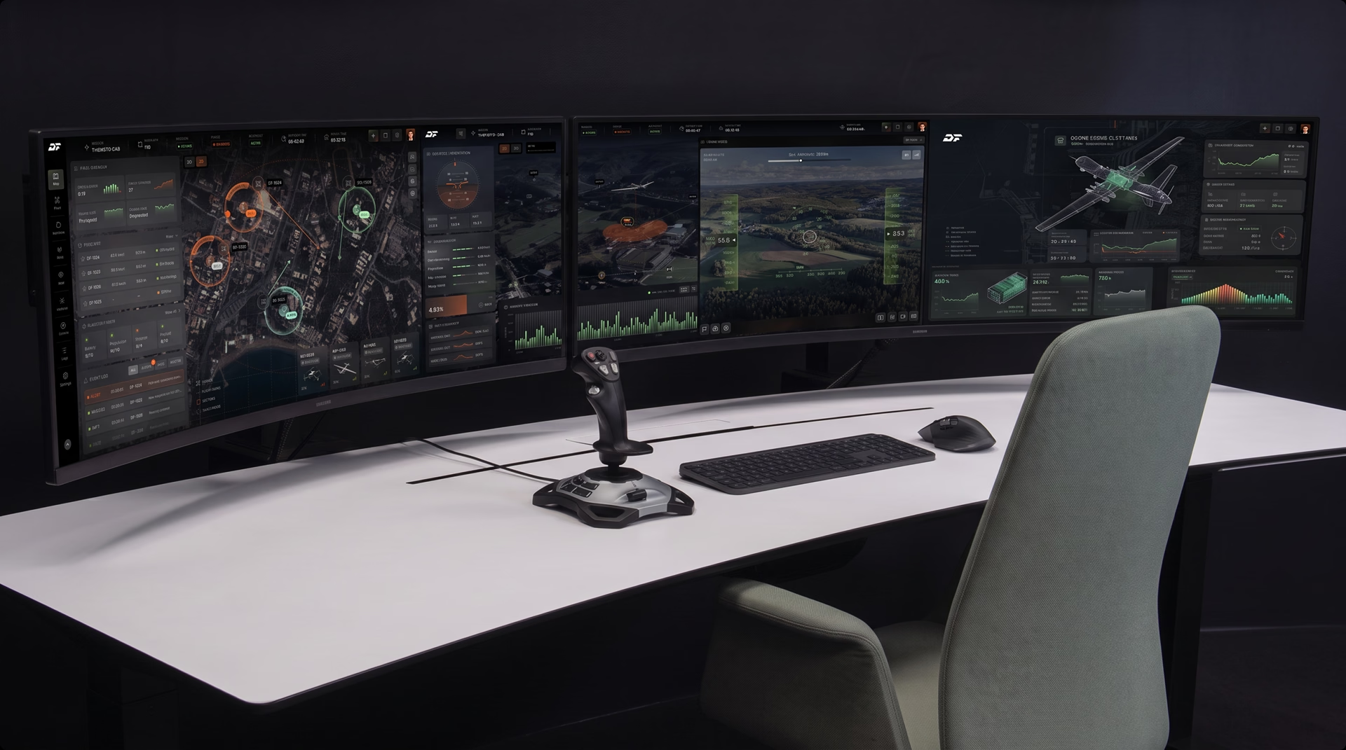
The result is a single platform for safer flights, stronger situational awareness, and reliable long-term deployment. Every screen shares one visual grammar, so an operator who learns one panel has learned them all, and the closing photograph shows what that buys: one operator, one workstation, a full mission in view.
We are a SaaS design
company that sticks
to our principles
Users don't come first
Business Comes
That doesn’t mean ignoring users. Every business benefits from understanding its users and improving the product for them. Being user-centered is valuable — but it’s valuable because it drives business success.
Structure is key
But Good UI Matters
That doesn’t mean ignoring users. Every business benefits from understanding its users and improving the product for them. Being user-centered is valuable — but it’s valuable because it drives business success.
Design is a process
Not An Event
There’s no place for overnight success. We work in short iterations, moving to the result bit by bit, and expect your consistent feedback.