Kestrel

Industries:
Description:

AI-powered command center for planning, tasking and tracking satellite and drone collection, turning operational goals into delivered intelligence.
Kestrel is an agentic AI platform for geospatial data collection across satellite and drone providers. We designed the interface its analysts and operators work in.

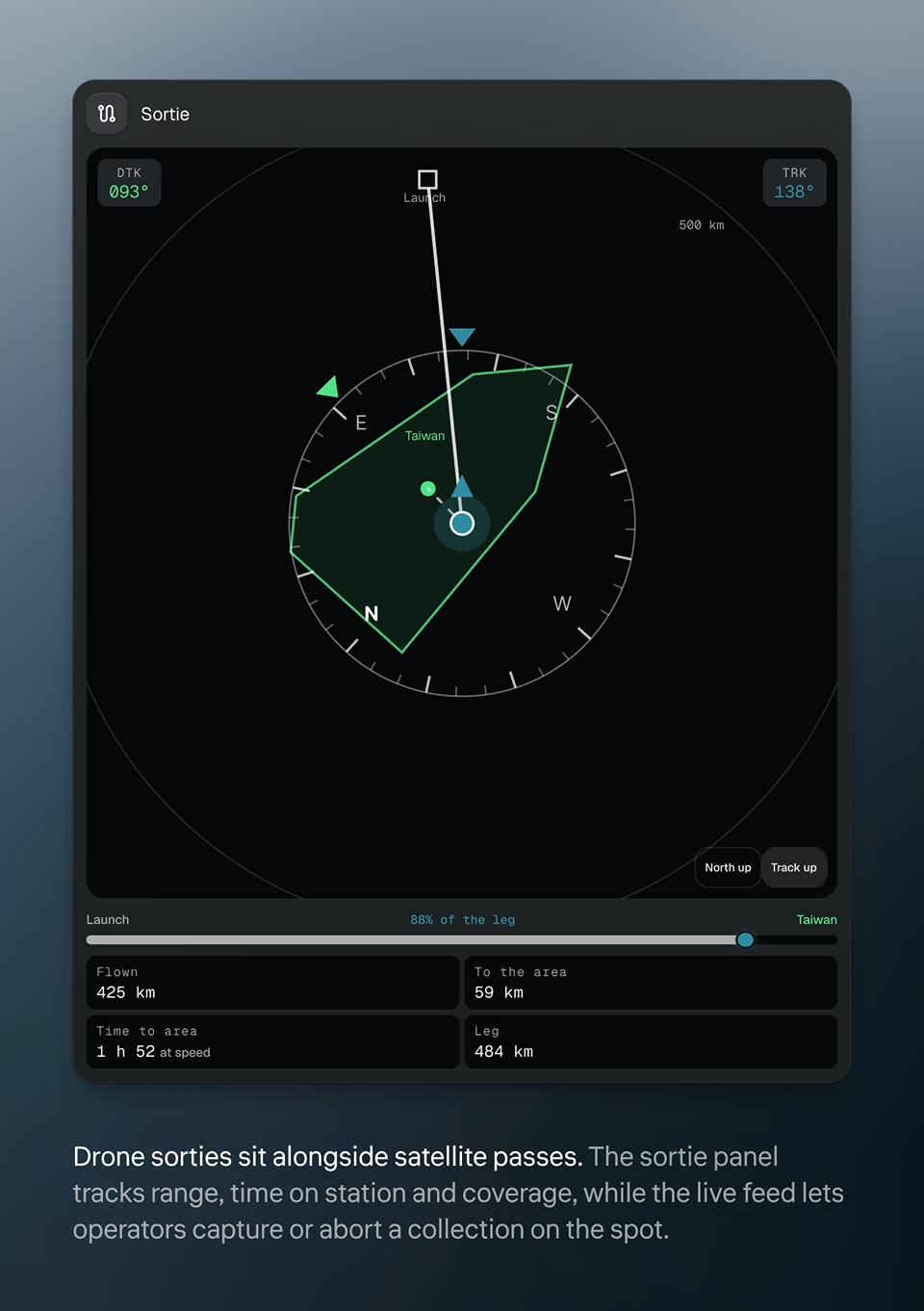
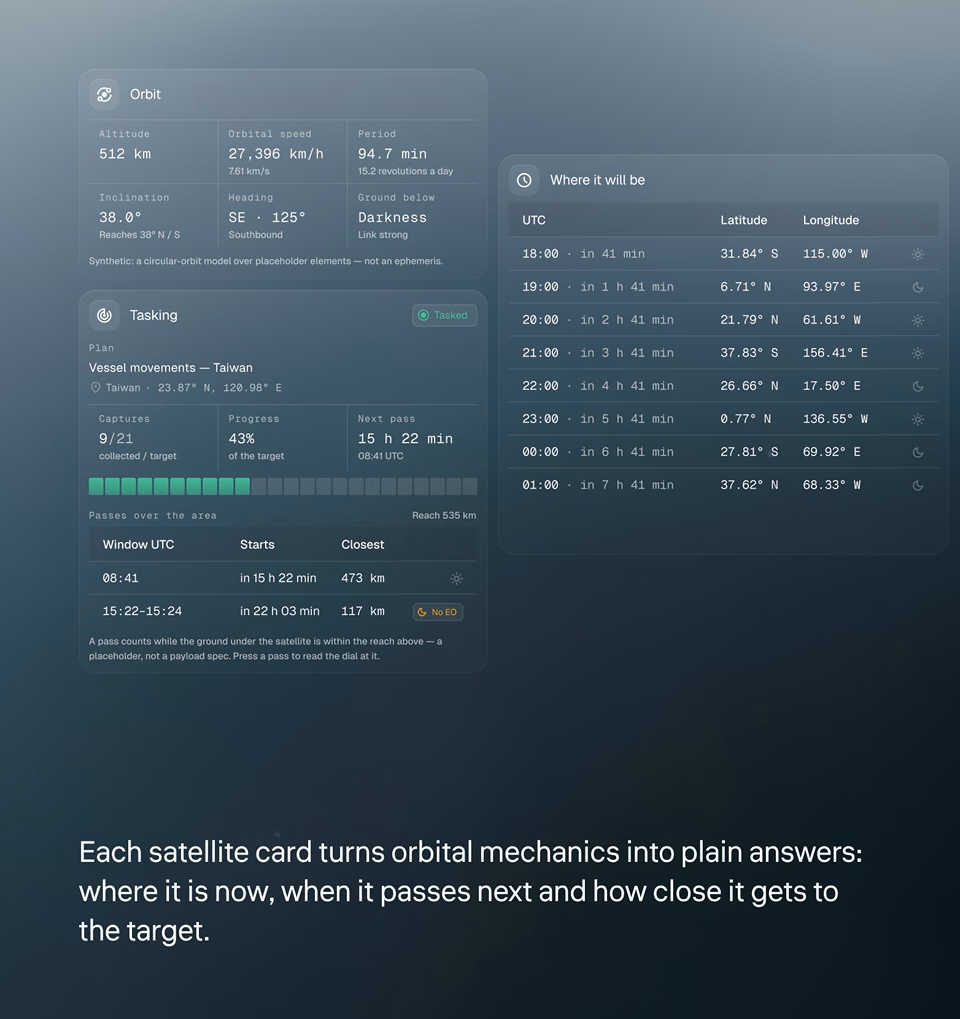
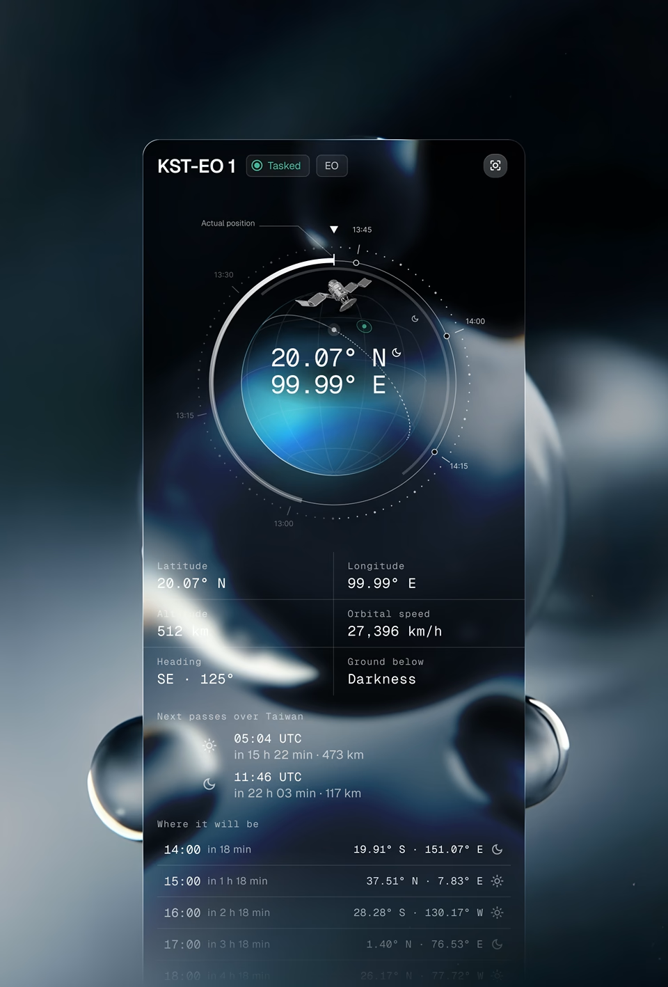
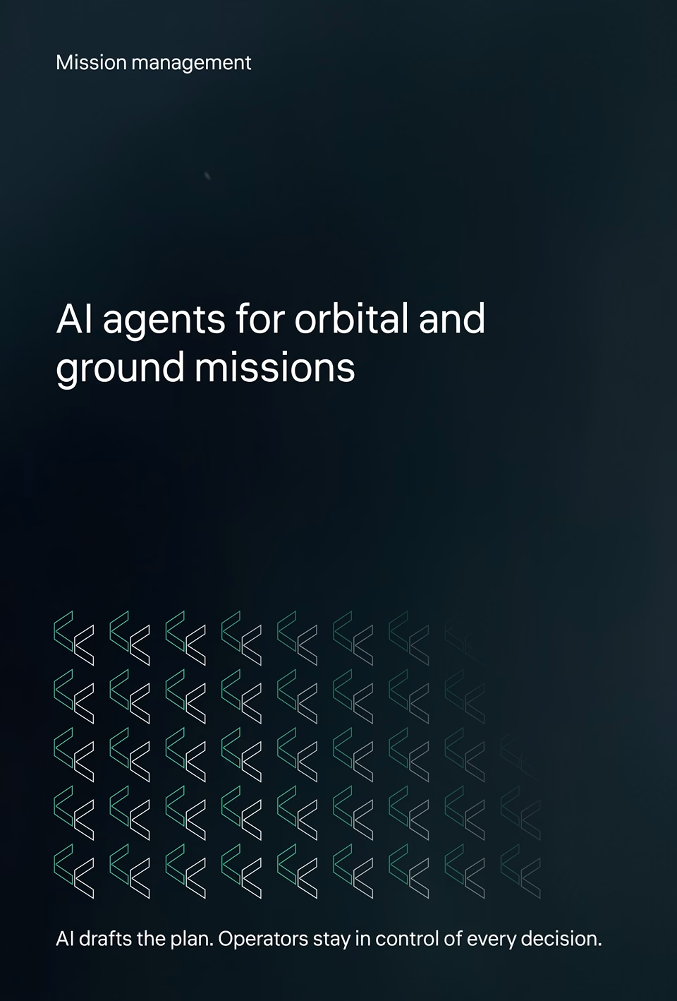
Kestrel satellite card for KST-EO 1 showing orbit dial, live position, altitude, speed and next passes over the target Kestrel mission management cover: AI agents for orbital and ground missions, with operators in control of every decision
Introduction

One command center for planning, tasking and tracking

Satellite tasking used to need specialists in sensors, orbits and provider rules. Kestrel hands that work to AI agents, so analysts describe what they need and get a feasible plan back. We designed the command center around that shift, from the live globe to the decision dashboards.

1

Simple Global Visualizations

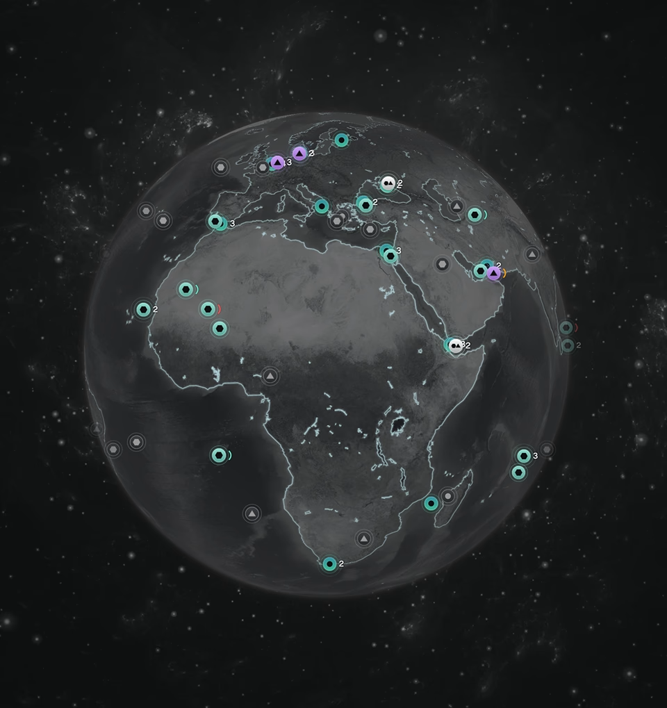
A live globe and map show every asset, target and collection window, so operators read the situation before they act.

2

Plan Management

Analysts build a collection plan step by step and see which sensors can cover each target before anything is tasked.

3

Conversational Assistant

An AI assistant drafts plans from plain-language requests, then stays on hand to explain options, flag issues and suggest retasks.

4

Data Visualization

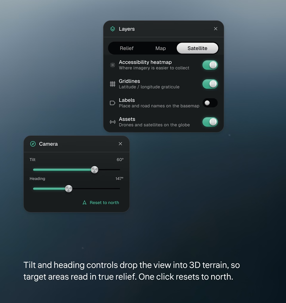
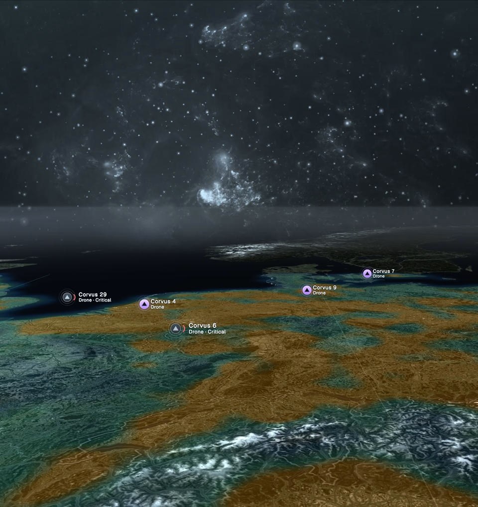
Timelines, coverage maps and 3D terrain turn the collection chain into something operators can see at a glance.

O

Orbit

When will this satellite see my target?

Every tasking decision depends on one question: when can a sensor see the target, and in what light. The orbit globe answers it for any asset, with its live position, next passes over the target and where it will be hour by hour, so analysts can task now or wait for a better pass.

Kestrel Dashboard Command Center 1
Telemetry

Real-time layers for tracking assets and adjusting plans

Live positions, orbits and task status share one view with chat commands, issue alerts and plan editing, so operators act without switching tools.

KPI-Heavy

Dashboards built around decisions, not data

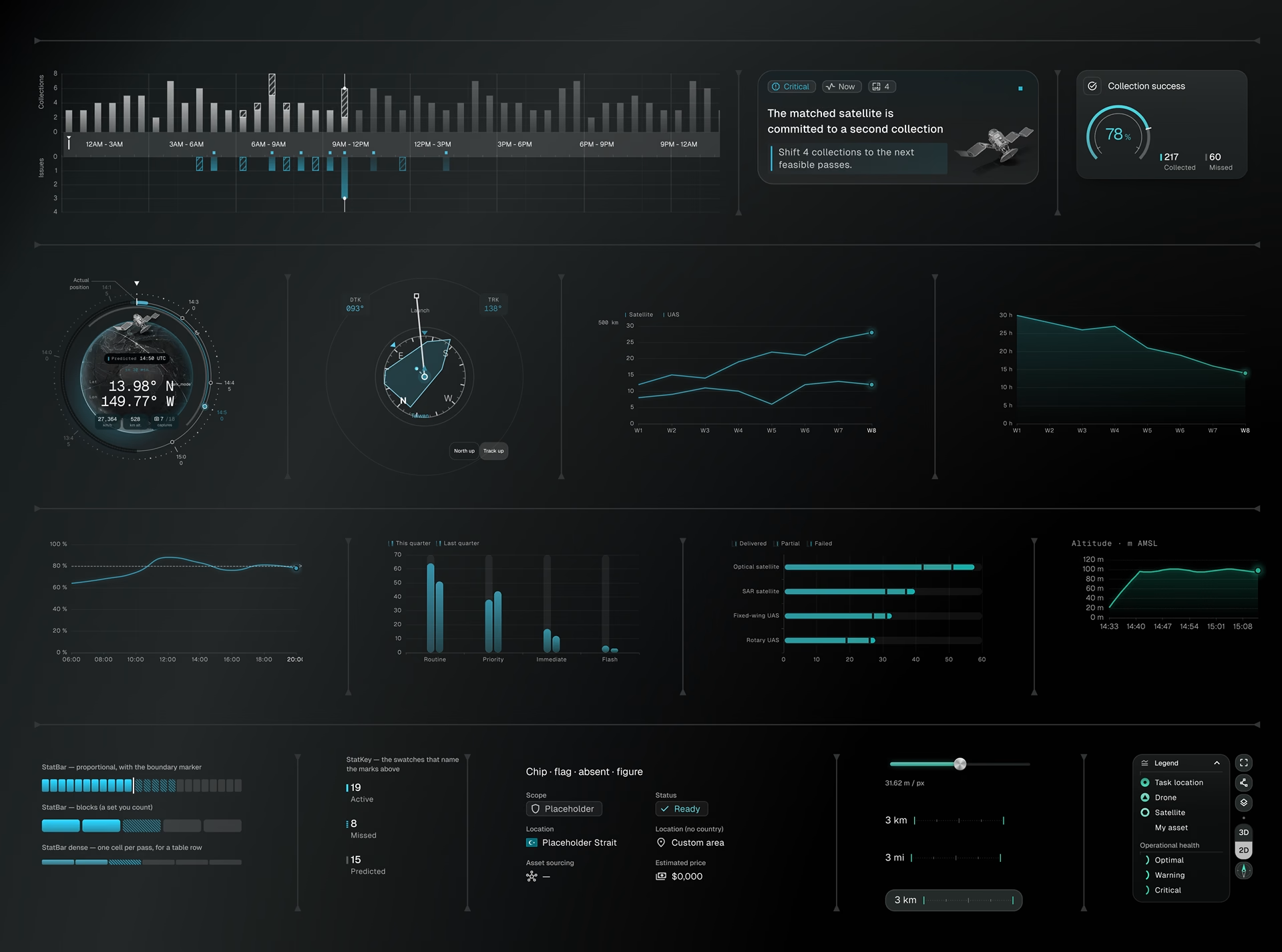
Each widget answers one operational question: what’s collecting, what’s at risk and what needs action. Charts, gauges and timelines share one visual language, so the picture reads instantly.

Kestrel dashboard components: collection timeline, success gauge, orbit dial, trend charts and asset health legend
Monitoring

From plain-language request to live collection plan

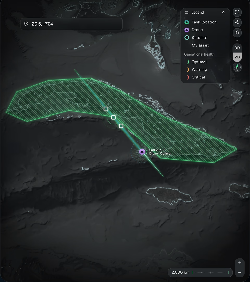
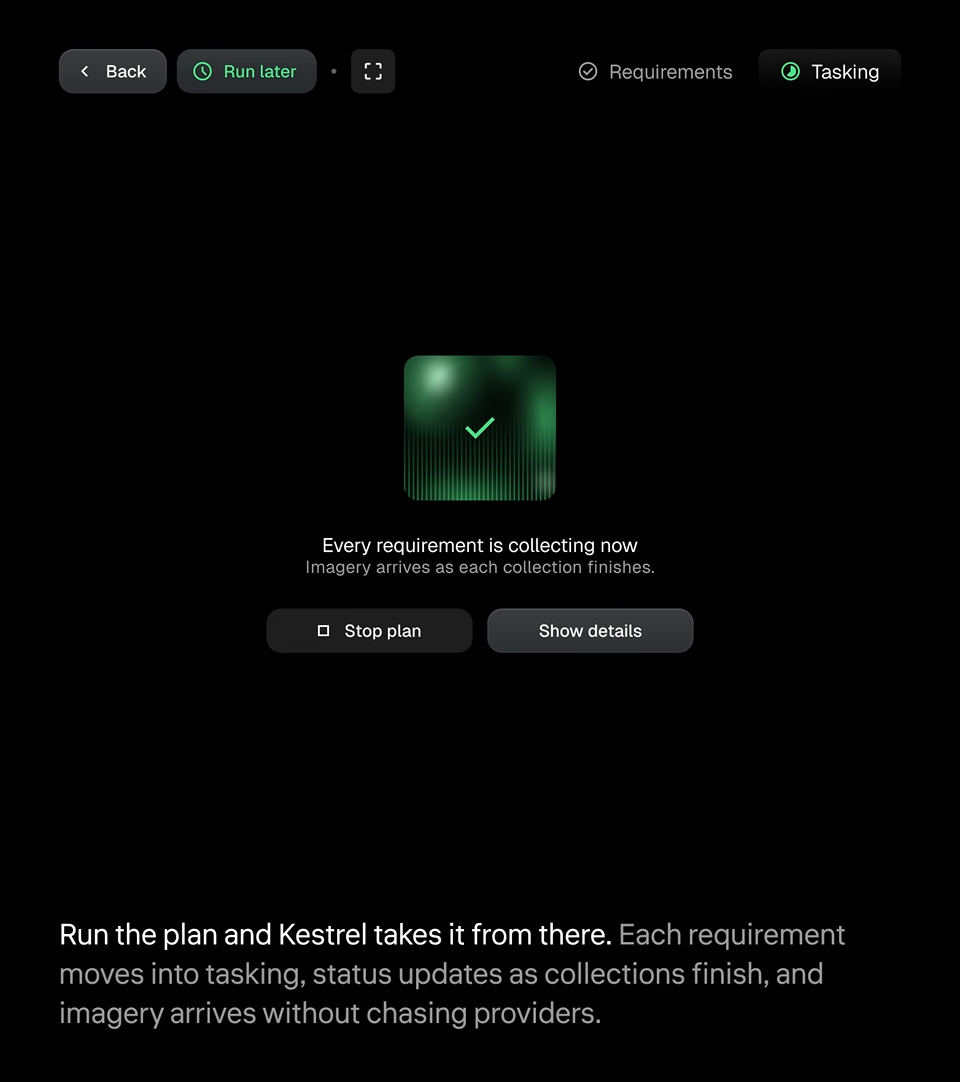
Operators start in chat or build the plan by hand, and both paths land in the same place. Once the plan runs, the map shows each task area and asset health, and imagery arrives as each collection finishes.

Kestrel 2D map of a collection task area with drone Corvus 7 on its flight path and operational health legend Kestrel tasking screen confirming every requirement is collecting, with options to stop the plan or view details

2

Ways to build a plan

Chat assistant or manual entry, kept in sync so operators can switch at any step.

1

Interface for every provider

Satellite and drone sensors from multiple providers, planned and tasked in one place.

7

Steps from request to retask

Plan, model, task, collect, deliver, assess and retask in one continuous loop.

Layers

Layered geospatial views built for changing conditions

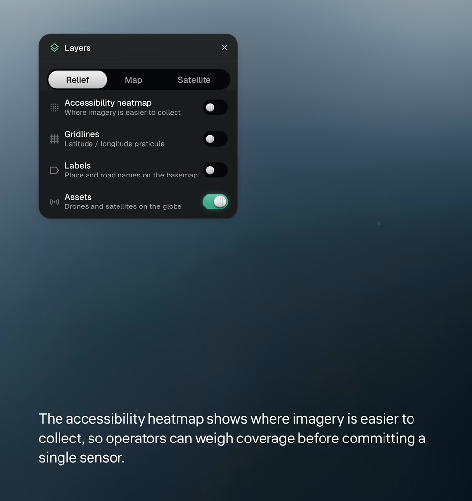
Relief, map and satellite basemaps sit under toggleable layers for assets, labels, gridlines and collection accessibility. Operators add only the context they need and keep the signal clear.
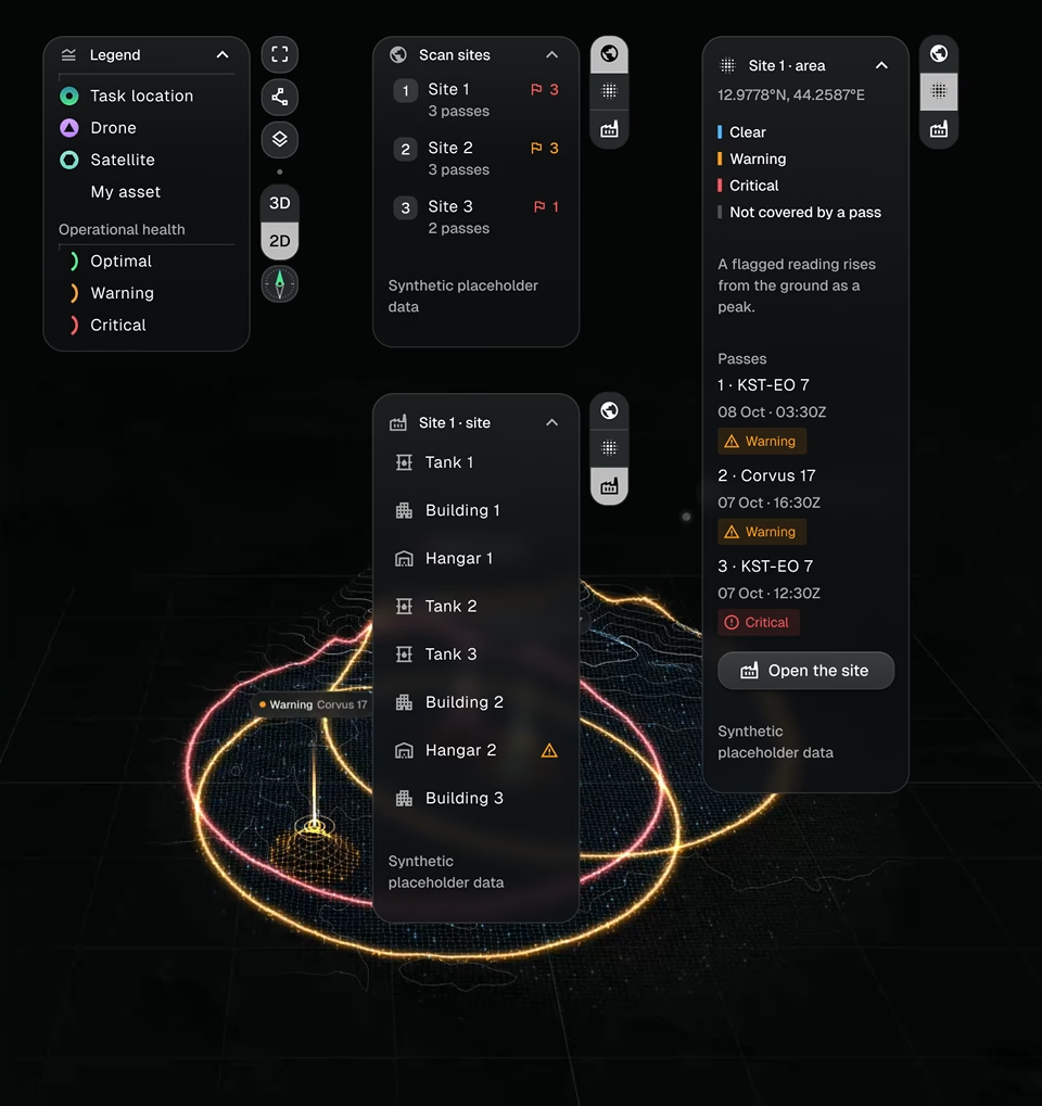
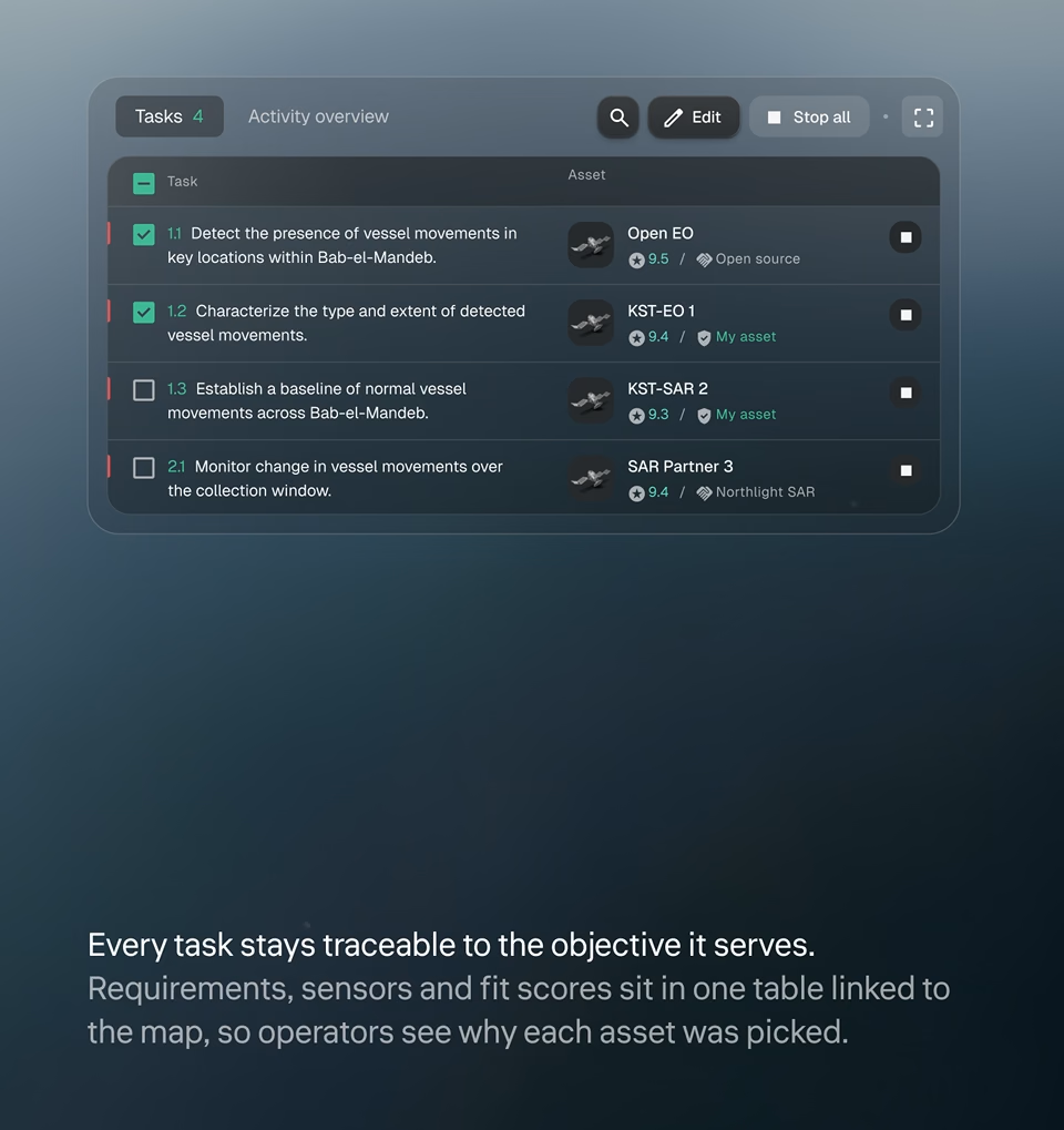
Kestrel 3D globe on the relief basemap with satellite and drone assets plotted over Africa and Europe Kestrel layers panel on the relief basemap with toggles for accessibility heatmap, gridlines, labels and assets Kestrel satellite basemap with heatmap and gridlines on, plus camera tilt and heading controls for 3D terrain Kestrel 3D terrain view with accessibility heatmap showing where imagery is easier to collect, and drones in the area Kestrel site view with scan sites, structures and satellite and drone pass rings marked clear, warning or critical Kestrel task table linking vessel-monitoring requirements to assigned satellite sensors and their fit scores
Experience Enhancement

Designed for analysts with no satellite background

Guided Planning

Templates and prompts show what each step needs, so first-time users can build a plan with confidence.

Clear Sensor Choices

Ranked options explain resolution, timing and fit for each target, so users know what they’re tasking.

Built-In Recovery

Backup assets and retask options surface when a collection is at risk, before the window closes.

Dynamics

Plans that adapt as targets and conditions move

Tasks, map and collection timeline update together. When a target shifts or a pass is lost, Kestrel flags the gap, surfaces backup assets and lets operators retask in a few clicks.
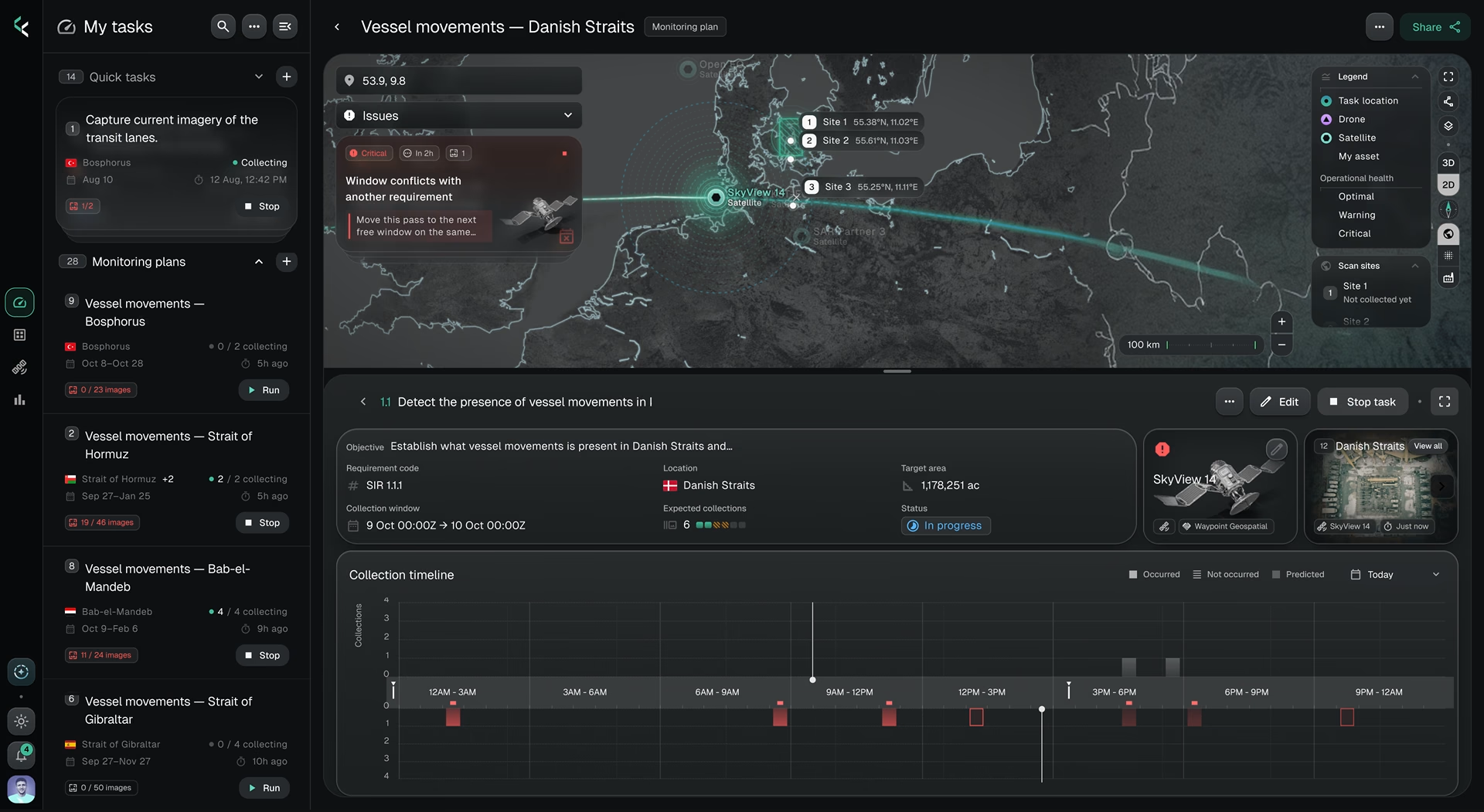
Kestrel plans that adapt as targets and conditions move
Collection

Every asset, orbit, and next pass

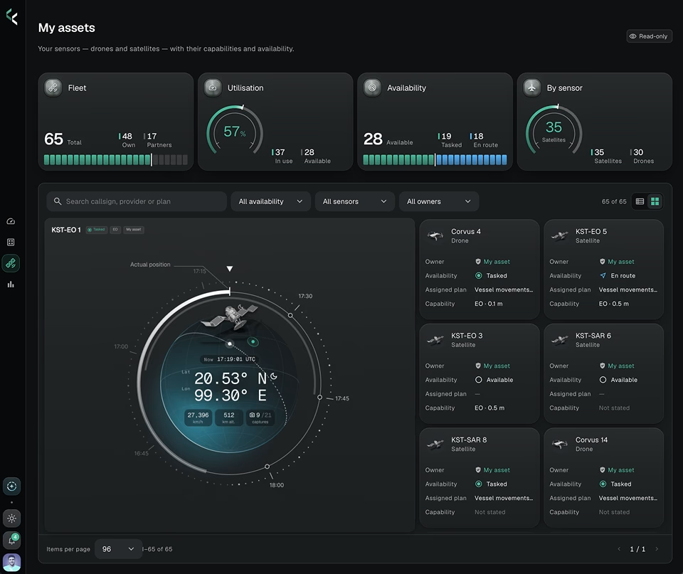
One live roster shows the status and tasking of every owned and partner sensor, so operators know what’s available before they plan.

Kestrel every asset orbit and next pass 1 Kestrel every asset orbit and next pass 2

Three principles behind every project we design
<span class="highlighted"><small>Users don't come first</small></span><br>Business Comes

Users don't come first
Business Comes

That doesn’t mean ignoring users. Every business benefits from understanding its users and improving the product for them. Being user-centered is valuable because it drives business success.
<span class="highlighted"><small>Structure is key</small></span><br>But Good UI Matters

Structure is key
But Good UI Matters

Understanding the relationship between function and design is the art of great UI/UX. Finding the sweet spot is what we do best.
<span class="highlighted"><small>Design is a process</small></span><br>Not An Event

Design is a process
Not An Event

There’s no place for overnight success. We work in short iterations, moving to the result bit by bit, and expect your consistent feedback.
Ready to work with us?

Contact Us

Featured projects

More AI, data visualization and mission-control work for complex, high-stakes products.